
Comprehensive Guide for LoRaWAN Enabled Remote Sensing and Geographic Information Systems (GIS)
Overview
The integration of LoRaWAN, remote sensing, and Geographic Information Systems (GIS) is transforming the Internet of Things (IoT) landscape. These technologies provide innovative ways to collect, transmit, and analyze spatial data, enabling advanced decision-making and automation in various fields. By combining the low-power, wide-area networking capabilities of LoRaWAN with the precision of remote sensing and the analytical power of GIS, businesses and researchers can unlock new opportunities in smart agriculture, environmental monitoring, urban planning, and beyond.
This guide offers a comprehensive exploration of how these technologies work individually and in unison to revolutionize IoT. It covers foundational concepts, technical implementations, challenges, and future trends, making it a valuable resource for professionals, students, and organizations seeking to harness the potential of LoRaWAN-enabled IoT systems. Detailed case studies and step-by-step instructions ensure practical insights alongside theoretical knowledge.
Whether you’re deploying a remote sensing network, optimizing IoT data visualization through GIS, or looking to understand the latest advancements in LoRaWAN technology, this guide provides the tools and knowledge needed to succeed.
Below are products and systems related to this webpage:
- LoRaWAN Gateways
- LoRaWAN End Devices
- Long Life LoRaWAN Gateways & Hubs
- ATEX LoRaWAN Gateways & Hubs
- LoRaWAN – Cloud, Server, PC & Mobile Systems
- Outdoor LoRaWAN End Devices
- Long Life LoRaWAN End Devices
Our products are in stock can be shipped to anywhere in continental U.S. or Canada from our local warehouse. To purchase or for any further information, please fill out this form or email us.
We are actively looking for partners who are like us located in the U.S. and Canada. For more information on partnering with GAO, please visit Partner with GAO Tek Inc. It lists various ways to partner with GAO, such as OEM Partnerships, Technology Integration, Distribution and Reselling Opportunities, Presenting at the Leading Event Tek Summit, Joint R&D Projects, Training and Consulting Services, Industry-Specific Collaborations, Research and Academic Partnerships.
1. Introduction to LoRaWAN, Remote Sensing, and GIS in IoT
The Convergence of LoRaWAN, Remote Sensing, and GIS in IoT
- LoRaWAN provides the foundation for low-power, long-range communication, enabling seamless data transmission across large geographic areas.
- Remote sensing enables data acquisition about objects or phenomena without direct contact, often through advanced sensors.
- GIS offers analytical and visualization capabilities, mapping and analyzing spatial data for actionable insights.
- The integration of these technologies forms a cohesive framework for monitoring, analyzing, and responding to real-world challenges efficiently.
Importance of Integrating These Technologies
- Enhanced Data Collection: LoRaWAN facilitates data transmission from remote and inaccessible locations.
- Applications: Smart agriculture, environmental monitoring, disaster management, urban planning.
- Long-Range Connectivity: LoRaWAN sensors transmit data over large geographic areas.
- Spatial Visualization: GIS interprets spatial patterns, converting raw data into actionable insights.
- Example: In agriculture, LoRaWAN sensors collect soil data, and GIS analyzes patterns for precision farming.
- Real-World Use Cases:
- Agriculture: Optimizing resource use and increasing crop yields through spatial analysis.
- Environmental Monitoring: Tracking deforestation and air quality with remote sensing and GIS tools.
Objectives of the Guide
- To explain foundational concepts of LoRaWAN, remote sensing, and GIS.
- To demonstrate the synergistic benefits of integrating these technologies.
- To provide step-by-step guidance for deploying LoRaWAN-enabled systems with GIS integration.
- To address challenges and present solutions using GAO Tek’s extensive experience.
- To highlight future trends in LoRaWAN, remote sensing, and GIS in IoT applications.
GAO Tek Inc., headquartered in New York City and Toronto, with its decades of experience in advanced B2B technologies, aims to empower organizations with this guide. Whether you’re a researcher, engineer, or industry professional, this resource equips you with the knowledge and tools to succeed in IoT innovations.
IoT technologies are revolutionizing agriculture by providing precise, actionable insights into farm operations. Key benefits include:
- Optimized resource use: Sensors monitor water levels, soil health, and weather conditions, minimizing wastage and improving resource allocation.
- Increased efficiency: Automated systems reduce manual labor while enhancing accuracy in processes such as irrigation, fertilization, and pest control.
- Enhanced traceability: IoT-enabled tracking ensures transparency across the supply chain, benefiting both producers and consumers.
GAO Tek offers IoT-enabled devices and platforms designed for seamless integration into diverse agricultural operations. These technologies align with industry standards set by organizations like the Institute of Electrical and Electronics Engineers (IEEE) to ensure interoperability and performance.
To learn more about IoT’s transformative role, visit the World Economic Forum’s insights on digital agriculture.
Overview of Challenges in Traditional Agriculture
Traditional farming methods face significant hurdles, including:
- Resource inefficiency: Overuse of water and fertilizers leads to environmental degradation and financial losses.
- Climate variability: Unpredictable weather patterns disrupt planting and harvesting cycles.
- Labor shortages: Declining availability of skilled labor impacts productivity and operational consistency.
IoT addresses these challenges by providing real-time data, predictive analytics, and automation. GAO Tek’s advanced IoT solutions enable farmers to overcome these barriers, ensuring resilience and profitability. For detailed insights, explore studies by the U.S. Department of Agriculture (USDA) and its programs supporting technology adoption in farming.
Key Concepts in Agricultural IoT
Agricultural IoT encompasses several core elements:
- Precision Agriculture: Using sensors and drones for site-specific crop management to optimize inputs and maximize outputs.
- Smart Irrigation Systems: IoT-enabled valves and pumps that regulate water flow based on soil moisture and weather data.
- Environmental Monitoring: Devices that track air quality, humidity, and temperature to protect crops and livestock.
- Supply Chain Optimization: RFID tags and GPS trackers ensure smooth logistics and traceability.
GAO Tek, supported by its sister companies GAO RFID Inc. and GAO Research Inc., provides an extensive portfolio of IoT devices, including environmental sensors, RFID solutions, and advanced communication modules. These products comply with global standards from the International Telecommunication Union (ITU) and other regulatory bodies.
Discover how connected agriculture can transform your operations by exploring the European Commission’s smart farming initiatives or engaging with GAO Tek’s expert team for tailored solutions.
2. Foundational Concepts
Basics of LoRaWAN
LoRaWAN (Long Range Wide Area Network) is a wireless communication protocol specifically designed for low-power, long-range IoT applications. It operates on unlicensed frequency bands, making it cost-effective for deploying IoT networks. LoRaWAN networks consist of end devices (sensors), gateways, and a network server, enabling communication across vast distances with minimal power consumption. This makes it ideal for applications requiring remote monitoring or data transmission across large geographic areas.
Key features of LoRaWAN include:
- Long Range: Coverage up to 10-15 kilometers in rural areas and 1-5 kilometers in urban settings.
- Low Power Consumption: Devices can run for years on small batteries, reducing maintenance costs.
- Scalability: Supports thousands of devices within a single network, making it suitable for large-scale IoT deployments.
- Robust Security: Offers encryption at both the network and application layers.
At GAO Tek Inc., we specialize in LoRaWAN-enabled devices and solutions, offering high-quality sensors and gateways that seamlessly integrate with IoT networks. Our advanced solutions cater to industries such as agriculture, environmental monitoring, and smart cities, empowering organizations to implement reliable and efficient IoT systems.
Overview of Remote Sensing Technologies
Remote sensing involves collecting data about objects or environments without direct contact, typically using sensors mounted on satellites, drones, or stationary platforms. These sensors capture data in various forms, including optical, thermal, and radar imagery.
Common types of remote sensing technologies include:
- Optical Sensors: Capture visible light and near-infrared data, widely used for vegetation analysis and land use monitoring.
- Thermal Sensors: Measure heat emissions, useful for detecting temperature variations and thermal anomalies.
- Radar Sensors: Provide data regardless of weather conditions or light availability, ideal for topographic mapping and monitoring natural disasters.
- Multispectral and Hyperspectral Sensors: Capture data across multiple wavelengths, enabling detailed analysis of material properties and environmental changes.
GAO Tek offers cutting-edge remote sensing solutions tailored to diverse applications. From environmental monitoring to disaster management, our technologies enable precise and actionable insights that enhance decision-making.
Introduction to Geographic Information Systems (GIS)
Geographic Information Systems (GIS) are powerful tools that store, analyze, and visualize spatial data. GIS integrates various data types, such as maps, satellite imagery, and IoT sensor data, to create comprehensive insights into geographic patterns and relationships.
Core components of GIS include:
- Data Capture: Ingests data from sources like GPS, satellites, and IoT devices.
- Data Storage and Management: Organizes spatial and attribute data in a geodatabase.
- Spatial Analysis: Examines spatial relationships to identify patterns, trends, and anomalies.
- Visualization: Creates interactive maps and 3D models to communicate insights effectively.
GIS has applications across numerous sectors, including urban planning, agriculture, environmental management, and logistics. For example, integrating IoT data from LoRaWAN sensors into GIS platforms enables real-time monitoring of air quality or water resources.
3. LoRaWAN in IoT
How LoRaWAN Works
LoRaWAN (Long Range Wide Area Network) is a protocol designed for the efficient transmission of small data packets over long distances. It operates in unlicensed frequency bands such as 868 MHz (Europe) and 915 MHz (North America), ensuring cost-effectiveness and flexibility for IoT applications. The architecture of LoRaWAN is structured into three primary components:
- End Devices: Sensors and IoT devices equipped with LoRa modules collect data and send it to the gateways. These devices are low-power, enabling extended battery life.
- Gateways: Serve as intermediaries between the end devices and the network server. Gateways receive data from multiple devices and forward it to the server using high-bandwidth connections like Ethernet or cellular networks.
- Network Server: Processes and manages the data received from gateways. It ensures secure data transmission by validating device identities and decrypting payloads.
This architecture allows LoRaWAN to support applications requiring long-range communication, such as environmental monitoring and smart city infrastructure.
Advantages of LoRaWAN for IoT Applications
- Extended Range: LoRaWAN enables connectivity across distances of up to 15 kilometers in rural areas and 5 kilometers in urban environments. This is ideal for IoT networks that span large geographical regions.
- Low Power Consumption: Devices using LoRaWAN can operate for years on a single battery, reducing maintenance costs and ensuring sustainability in remote deployments.
- High Scalability: A single LoRaWAN network can support thousands of devices, making it suitable for dense IoT applications such as smart agriculture and industrial automation.
- Robust Security: LoRaWAN uses AES-128 encryption at both the network and application layers, providing secure data transmission.
- Cost-Effectiveness: Operating in unlicensed frequency bands eliminates licensing fees, reducing the total cost of ownership for IoT solutions.
At GAO Tek Inc., we leverage LoRaWAN’s advantages to deliver robust IoT solutions that empower industries. Our expertise in deploying large-scale networks ensures seamless integration and optimized performance for diverse applications.
Key Hardware and Software Components
- Hardware Components:
- LoRaWAN Sensors: Devices that capture environmental, industrial, or operational data. Examples include temperature sensors, soil moisture sensors, and air quality monitors.
- Gateways: Devices that relay data from sensors to the network server. Gateways are designed for durability and performance in both indoor and outdoor settings.
- Antennas: Essential for enhancing the range and reliability of communication between devices and gateways.
- Software Components:
- Network Server Software: Manages device registration, data routing, and network integrity.
- Device Management Platforms: Provide tools for monitoring, configuring, and maintaining IoT devices.
- Application Software: Translates raw data into actionable insights through visualization, analytics, and reporting.
GAO Tek offers a comprehensive portfolio of hardware and software solutions for LoRaWAN networks. From high-quality sensors to sophisticated management platforms, our products are designed to meet the unique needs of IoT deployments in industries such as agriculture, healthcare, and energy management. Our long-standing reputation for innovation and quality ensures that our customers receive reliable solutions backed by exceptional technical support.
4. Remote Sensing Applications in IoT
Types of Sensors Used in IoT
Remote sensing relies on an array of sensors tailored to capture specific types of environmental or operational data. Each sensor type contributes to the versatility and precision of IoT applications:
- Environmental Sensors: Monitor temperature, humidity, and atmospheric pressure. Essential for agricultural and environmental monitoring applications.
- Imaging and Optical Sensors: Capture visual and thermal data for mapping, surveillance, and resource management. Widely used in drones and satellite applications.
- Motion and Proximity Sensors: Detect movement or the presence of objects, critical for industrial automation and security.
- Soil and Agricultural Sensors: Provide data on soil moisture, pH, and nutrient levels for precision farming.
- Acoustic and Seismic Sensors: Measure sound waves or vibrations, valuable in geological surveys and monitoring infrastructure stability.
GAO Tek Inc. provides a range of cutting-edge sensors, ensuring compatibility with LoRaWAN networks for reliable long-range communication in IoT systems.
Data Collection and Analysis for IoT Systems
Data collection in IoT systems involves transferring information from sensors to centralized or distributed platforms where analysis occurs:
- Data Collection: Sensors continuously gather data, which is transmitted via networks like LoRaWAN. The long-range and low-power capabilities of LoRaWAN make it ideal for remote and hard-to-reach locations.
- Processing and Analysis: Collected data undergoes filtering, validation, and transformation to ensure it is accurate and actionable. AI-driven analytics can provide deeper insights and predictive capabilities.
- Visualization and Decision Support: Interactive dashboards and GIS mapping tools display analyzed data, enabling users to monitor trends, identify anomalies, and make informed decisions.
GAO Tek offers IoT solutions integrated with data management platforms that streamline data collection, processing, and visualization, helping organizations optimize their operations.
Examples of Remote Sensing Use Cases
Remote sensing applications span various industries, demonstrating its adaptability and impact:
- Smart Agriculture: Sensors monitor soil conditions and crop health, optimizing irrigation and fertilization practices. LoRaWAN connectivity ensures data from rural areas reaches centralized systems efficiently.
- Environmental Conservation: Thermal imaging and optical sensors help monitor deforestation and wildlife habitats, aiding conservation efforts.
- Infrastructure Management: Remote sensors assess the structural integrity of bridges, pipelines, and buildings, enabling predictive maintenance.
- Natural Disaster Response: Drones equipped with imaging sensors survey disaster-hit areas, guiding rescue and relief operations.
- Water Resource Management: IoT systems with hydrological sensors monitor water quality and levels in rivers and reservoirs, ensuring sustainable management.
GAO Case Studies
USA Case Studies
- Smart Farming in Fresno, CA
IoT sensors monitor soil moisture and weather conditions in farmlands, enabling farmers to optimize irrigation schedules and reduce water usage. - Traffic Monitoring in New York, NY
Motion and proximity sensors integrated into LoRaWAN networks provide real-time traffic flow data, improving congestion management in urban areas. - Flood Monitoring in Houston, TX
Water-level sensors along key flood-prone areas send alerts during heavy rains, allowing for timely evacuations and mitigation efforts. - Air Quality Management in Los Angeles, CA
Environmental sensors track air pollution levels, providing data to city officials for implementing emission-reduction strategies. - Wildfire Detection in Denver, CO
Thermal sensors deployed in forested areas detect temperature anomalies, alerting authorities to potential wildfires. - Pipeline Monitoring in Dallas, TX
Acoustic sensors detect pressure changes and leaks in critical pipelines, reducing downtime and environmental risks. - Coastal Erosion Study in Miami, FL
Optical and imaging sensors monitor coastal changes, helping authorities develop strategies to mitigate erosion. - Urban Development in Chicago, IL
GIS-integrated IoT systems monitor construction progress, ensuring compliance with urban planning regulations. - Smart Lighting in San Francisco, CA
IoT sensors control streetlights based on real-time traffic and pedestrian data, enhancing energy efficiency. - Seismic Monitoring in Seattle, WA
Seismic sensors in high-risk areas provide data to predict and analyze earthquakes. - Water Management in Phoenix, AZ
Hydrological sensors monitor water quality and supply in reservoirs, promoting sustainable resource use. - Industrial Automation in Detroit, MI
Motion sensors integrated into LoRaWAN networks optimize robotic assembly lines, enhancing productivity. - Wildlife Tracking in Yellowstone National Park, WY
GPS-enabled sensors monitor animal movements, aiding conservationists in protecting endangered species. - Energy Management in Boston, MA
IoT sensors track energy usage in office buildings, providing insights for reducing consumption. - Disaster Recovery in New Orleans, LA
Remote sensing technology monitors flood recovery progress post-hurricane, enabling efficient resource allocation.
Canada Case Studies
- Forest Management in Vancouver, BC
Thermal imaging sensors monitor forest health and detect early signs of wildfires, aiding conservation efforts. - Air Pollution Study in Toronto, ON
Environmental sensors across the city provide air quality data, helping policymakers devise pollution-reduction measures.
5. Integrating GIS with LoRaWAN and IoT
Role of GIS in Visualizing and Analyzing IoT Data
Geographic Information Systems (GIS) play a pivotal role in transforming raw IoT data into actionable insights by mapping spatial relationships and patterns. When integrated with LoRaWAN and IoT, GIS enhances data interpretation and decision-making processes:
- Data Visualization: GIS provides advanced mapping capabilities to display IoT sensor data spatially, enabling users to understand location-based trends. For example, real-time air quality data from LoRaWAN-connected sensors can be overlaid on a city map to identify pollution hotspots.
- Trend Analysis: Time-series data from IoT devices can be combined with GIS to analyze changes over time. This is particularly useful in environmental monitoring and urban planning applications.
- Resource Optimization: GIS can identify inefficiencies by correlating IoT sensor data with geographic variables, such as optimizing irrigation in agricultural fields based on soil moisture sensor readings.
- Emergency Response: Real-time mapping of disaster data collected via IoT sensors can guide rapid and efficient response efforts.
GAO Tek Inc. integrates GIS capabilities into its IoT solutions, providing clients with powerful tools to visualize and analyze sensor data spatially and temporally.
Mapping and Spatial Analysis of Sensor Data
The combination of GIS with LoRaWAN-enabled IoT systems opens up advanced possibilities for mapping and spatial analysis, which are essential for precision and informed decision-making:
- Sensor Deployment Mapping: GIS enables planners to map and manage sensor networks, ensuring optimal placement of LoRaWAN-connected sensors for maximum coverage and efficiency.
- Data Layering: GIS can overlay multiple data sets, such as temperature, humidity, and soil moisture, on a single map. This layered visualization supports comprehensive spatial analysis.
- Predictive Modeling: By integrating GIS with machine learning, predictive models can forecast environmental conditions or resource requirements based on IoT sensor data.
- Geofencing: GIS can define virtual boundaries for assets or areas of interest, triggering alerts when IoT devices detect breaches or anomalies within those zones.
- Hotspot Identification: Spatial analysis using GIS can pinpoint clusters of activity, such as areas with high energy consumption, enabling targeted interventions.
GAO Tek’s expertise lies in creating seamless integrations between GIS, LoRaWAN, and IoT, delivering solutions that simplify complex spatial analyses. Our team ensures that these tools are user-friendly, allowing clients to leverage the full potential of their data.
6. Technical Implementation
Step-by-Step Setup of a LoRaWAN-Enabled IoT System
- Define Objectives and Requirements
Start by identifying the goals of your IoT system. Define key performance indicators (KPIs) and technical requirements such as data types, frequency of communication, and geographic coverage. GAO Tek Inc. provides consultation to ensure a clear roadmap tailored to your business needs. - Choose Suitable Sensors
Select sensors based on the parameters you need to measure, such as temperature, humidity, air quality, or motion. GAO Tek offers a wide range of high-quality sensors compatible with LoRaWAN protocols. - Select LoRaWAN Gateways
Gateways act as bridges between the sensors and the cloud. Evaluate gateways based on coverage, throughput, and environmental factors. GAO Tek can assist in sourcing and deploying gateways optimized for your setup. - Deploy Gateways Strategically
Install gateways at optimal locations for maximum coverage. Ensure proper elevation and minimal interference for effective data transmission. - Configure Sensors and Gateways
- Pair sensors with gateways using unique identifiers.
- Set the communication parameters, such as frequency bands and data rates.
- Use network servers to manage and monitor connections.
- Integrate a Network Server
Use a LoRaWAN network server to handle device registration, data routing, and security. Popular choices include The Things Stack or ChirpStack. GAO Tek ensures seamless integration with reliable servers to manage your network efficiently. - Connect to the Cloud
Configure gateways to forward data to cloud-based storage and analytics platforms. This enables scalability and access to advanced analytical tools. - Test and Optimize
Perform rigorous testing to validate the system’s functionality. Fine-tune settings for data accuracy and energy efficiency. GAO Tek’s expert team supports testing and optimization remotely or onsite.
Integrating Sensors and Gateways
Integrating sensors and gateways is a critical step to ensure smooth data flow in a LoRaWAN network:
- Sensor Configuration: Sensors should be programmed with the correct Application Identifier (AppEUI) and Device Address (DevAddr). This ensures secure communication within the network.
- Gateway Deployment: LoRaWAN gateways should be strategically placed to avoid data collisions and ensure redundancy.
- Power Management: For outdoor or remote locations, consider solar-powered gateways and battery-efficient sensors.
- Monitoring Tools: Utilize software platforms for real-time monitoring of sensor health and gateway performance.
GAO Tek provides advanced integration solutions, ensuring compatibility and robust performance across diverse IoT environments.
Connecting IoT Data to GIS Platforms
Integrating IoT data with GIS platforms unlocks powerful spatial analysis capabilities:
- Data Ingestion
- Configure APIs or MQTT protocols to transfer sensor data from the cloud to GIS systems.
- GAO Tek facilitates secure and efficient data pipelines tailored to industry-specific needs.
- Data Preparation
- Process raw sensor data into GIS-compatible formats such as shapefiles or GeoJSON.
- Ensure that data attributes (e.g., timestamp, geolocation) are accurately aligned.
- GIS Software Integration
- Use GIS platforms like Esri ArcGIS, QGIS, or Mapbox for visualization.
- Establish data connections using REST APIs or plugins for dynamic mapping.
- Real-Time Mapping
- Implement real-time updates to visualize sensor activity and environmental changes as they occur.
- Create geospatial dashboards to monitor trends and anomalies.
- Advanced Spatial Analytics
- Apply GIS tools for hotspot analysis, resource planning, or predictive modeling.
- Incorporate historical data to enhance analytical insights.
GAO Tek specializes in bridging IoT and GIS technologies, providing end-to-end solutions that enable businesses to harness the full potential of their geospatial and IoT data. Our expertise ensures efficient system deployment and ongoing support for cutting-edge performance.
7. Challenges and Solutions
Common Technical and Operational Challenges
- Limited Coverage in Remote Areas
LoRaWAN relies on gateway placement to provide coverage, which can be challenging in rural or remote locations with sparse infrastructure. - Interference and Signal Degradation
Environmental factors like buildings, mountains, and weather can affect signal quality and data transmission reliability. - Power Consumption
Although LoRaWAN devices are energy-efficient, continuous operation in extreme environments can strain battery life. - Data Integration Complexity
Integrating IoT data from LoRaWAN systems with GIS platforms can be complex due to differences in data formats and systems. - Scalability Issues
Expanding LoRaWAN systems to support additional sensors and devices can strain network capacity and create latency. - Security Concerns
LoRaWAN networks, if not properly secured, can be vulnerable to eavesdropping, spoofing, and other cyber threats.
GAO Tek Inc., with its deep expertise and quality assurance processes, addresses these challenges through customized solutions designed for reliability and efficiency.
Strategies to Overcome Obstacles
- Optimized Gateway Deployment
- Use coverage mapping tools to identify ideal locations for gateway installation.
- Deploy redundant gateways in high-risk areas to minimize downtime.
- GAO Tek provides tools and guidance for optimal network planning to maximize coverage and reliability.
- Signal Enhancement Techniques
- Use high-gain antennas to boost signal strength.
- Implement frequency hopping to minimize interference.
- Our team at GAO Tek offers advanced equipment and expert assistance to mitigate signal degradation effectively.
- Battery Management Solutions
- Utilize solar panels or other renewable energy sources for off-grid sensor power.
- Program sensors for low-power operation during non-critical periods.
- GAO Tek’s portfolio includes energy-efficient devices and monitoring tools to prolong system lifespan.
- Streamlined Data Integration
- Employ middleware platforms to transform raw IoT data into GIS-compatible formats.
- Use APIs to automate data synchronization.
- GAO Tek provides customized integration solutions to bridge IoT data with GIS systems seamlessly.
- Scalability Planning
- Design LoRaWAN networks with modular architecture to support future expansion.
- Employ load balancing techniques to distribute traffic across gateways.
- GAO Tek supports scalability through tailored hardware and software configurations.
- Enhanced Security Measures
- Encrypt communication between devices and gateways using AES-128 encryption.
- Regularly update firmware to protect against emerging threats.
- Implement multi-factor authentication (MFA) for network access.
- GAO Tek ensures robust security by integrating industry best practices into every deployment.
Best Practices
- Comprehensive Pre-Deployment Testing
- Simulate operational conditions to identify potential issues before installation.
- Conduct signal strength tests to determine gateway and sensor placement.
- Regular Maintenance and Updates
- Schedule periodic inspections to ensure hardware and software are functioning correctly.
- Update firmware and security protocols to address vulnerabilities.
- User Training and Support
- Train stakeholders on system operation and troubleshooting.
- Provide clear documentation for installation and usage. GAO Tek supports clients with extensive training resources and 24/7 technical assistance.
- Leverage Analytics for Decision-Making
- Use real-time analytics to monitor system performance and identify optimization opportunities.
- Implement predictive maintenance to reduce downtime and extend device life.
GAO Tek Inc.’s four decades of experience in the B2B technology space position us to provide innovative solutions that help businesses overcome the challenges of implementing and maintaining LoRaWAN-enabled IoT systems. From strategic planning to ongoing support, we empower our clients to achieve operational excellence.
8. Future Trends and Innovations
Innovations in LoRaWAN and IoT
- Extended Range and Improved Coverage
Advances in LoRaWAN technology are focusing on enhanced signal penetration and longer communication ranges, particularly for urban and remote areas. The adoption of multi-hop networking is expected to significantly improve network coverage. - Increased Data Rates
Emerging iterations of LoRaWAN are expected to deliver higher data rates without compromising energy efficiency, expanding its applicability to more data-intensive use cases such as real-time video monitoring or large-scale environmental analysis. - Enhanced Interoperability
Open standards and protocols will drive seamless integration between LoRaWAN devices and other IoT ecosystems. Interoperability improvements will simplify the deployment of hybrid IoT systems. - Energy Harvesting Technologies
Future LoRaWAN devices are likely to integrate energy harvesting capabilities, such as solar or kinetic energy, reducing dependency on traditional battery power and enabling perpetual operation in remote sensing environments. - AI-Driven Optimization
Artificial intelligence and machine learning will play a vital role in optimizing LoRaWAN networks by predicting traffic patterns, identifying bottlenecks, and automating resource allocation for enhanced efficiency.
GAO Tek Inc. is committed to staying at the forefront of these innovations, offering cutting-edge LoRaWAN devices and solutions tailored to meet evolving industry demands.
Emerging GIS Technologies
- 3D GIS for Enhanced Spatial Visualization
With the advent of 3D GIS, spatial data can now be visualized in three dimensions, providing a richer perspective for analyzing urban landscapes, infrastructure planning, and environmental modeling. - Real-Time GIS
Real-time GIS applications are emerging as a critical component for dynamic systems such as traffic management, disaster response, and live environmental monitoring, enabled by the continuous flow of IoT data. - Blockchain Integration
Blockchain technology is being explored to ensure the security and integrity of spatial data, offering decentralized verification for critical GIS datasets. - Geospatial AI
The integration of AI into GIS platforms allows for predictive analysis, such as forecasting urban growth patterns or identifying at-risk ecosystems based on spatial data trends. - Cloud-Native GIS Platforms
Cloud-based GIS systems are becoming the norm, allowing users to access, analyze, and share spatial data from anywhere. This scalability is particularly beneficial for large-scale IoT and LoRaWAN deployments.
GAO Tek enables its clients to capitalize on these advancements by integrating GIS solutions with IoT systems, ensuring seamless access to the latest technologies for improved decision-making and operational efficiency.
Predicted Advancements in Integration
- Unified Platforms for IoT and GIS
The future of IoT and GIS integration lies in unified platforms that combine sensor data collection, spatial analysis, and visualization in a single interface. These platforms will simplify workflows and enhance usability. - Edge Computing for Localized Processing
The deployment of edge computing nodes in LoRaWAN networks will allow for real-time data processing at the source, reducing latency and dependency on centralized systems. - Standardized Data Models
Industry-wide adoption of standardized data models will streamline the integration of IoT and GIS systems, ensuring consistent data interpretation across platforms. - Advanced Automation Tools
Automation tools for integrating IoT sensor data into GIS platforms will reduce manual intervention, speeding up workflows and minimizing errors. - Collaborative Spatial Intelligence
Future integrations will foster collaboration between stakeholders by enabling multi-user access to geospatial insights, paving the way for joint planning and decision-making.
GAO Tek continues to develop robust, future-ready solutions that bridge the gap between IoT and GIS technologies. Leveraging our extensive R&D capabilities, we aim to empower organizations with scalable, secure, and innovative tools for the next generation of smart systems.
9. Conclusion
Summary of Insights and Key Takeaways
The integration of LoRaWAN technology with remote sensing and Geographic Information Systems (GIS) has transformed the landscape of IoT-enabled solutions, offering unparalleled opportunities for data collection, transmission, analysis, and visualization. Key takeaways include:
- Scalable Connectivity with LoRaWAN
LoRaWAN offers long-range, low-power communication ideal for large-scale IoT deployments in both urban and remote areas. Its scalability makes it suitable for applications ranging from smart cities to precision agriculture. - Enhanced Decision-Making Through GIS Integration
GIS adds a critical spatial dimension to IoT data, enabling detailed mapping and advanced spatial analysis. This synergy enhances decision-making across industries, from disaster management to environmental monitoring. - Challenges Require Strategic Solutions
Implementing LoRaWAN-enabled IoT systems and integrating them with GIS is not without challenges. Issues such as network scalability, data security, and interoperability must be addressed with robust strategies, such as adopting open standards and leveraging edge computing. - Future Trends Point to Increasing Innovation
Emerging technologies such as real-time GIS, geospatial AI, and energy-efficient IoT devices continue to push the boundaries of what is possible, paving the way for smarter and more efficient systems.
At GAO Tek Inc., we believe these technologies represent a cornerstone of the digital transformation era. By offering innovative, customizable, and high-quality solutions, we empower organizations to harness these advancements for real-world impact.
Recommendations for Practitioners
- Adopt a Comprehensive Approach
Practitioners should develop a holistic strategy for IoT implementation, prioritizing seamless integration of LoRaWAN with GIS platforms. Investing in systems that ensure data accuracy and interoperability is essential. - Leverage Expert Support
Collaboration with experienced solution providers, such as GAO Tek, can simplify the deployment process and reduce the risk of technical hurdles. Our technical teams provide remote and on-site assistance to ensure smooth system integration. - Stay Ahead of Emerging Trends
Stay informed about the latest developments in LoRaWAN and GIS technologies. Engaging with industry leaders, attending conferences, and investing in training for new tools are essential steps to remain competitive. - Prioritize Security and Data Integrity
Implement robust cybersecurity measures, including encryption, regular audits, and secure communication protocols. Additionally, practitioners should explore blockchain solutions for data validation in GIS applications. - Focus on Sustainability
Incorporating energy-efficient devices and renewable energy sources into IoT deployments reduces operational costs and aligns with global sustainability goals. - Utilize Scalable Solutions
Ensure your IoT systems are designed to grow with your needs. Scalable architectures, such as those offered by GAO Tek, are critical to maintaining performance as data volumes and application demands increase.
At GAO Tek Inc., headquartered in New York City and Toronto, Canada, we are dedicated to providing advanced, future-ready solutions that address these recommendations. Our four decades of expertise and investments in R&D have enabled us to support organizations ranging from Fortune 500 companies to cutting-edge R&D firms, delivering unparalleled innovation and quality. For further information on our solutions, visit GAO Tek’s website
10. Appendix
Glossary of Terms
- LoRa (Long Range)
A wireless communication technology designed for low-power, long-range IoT applications. LoRa is the underlying physical layer of LoRaWAN. - LoRaWAN (Long Range Wide Area Network)
A communication protocol and system architecture for IoT networks that enables long-range data transmission at low power. - IoT (Internet of Things)
A network of physical devices embedded with sensors, software, and connectivity to collect and exchange data. - GIS (Geographic Information System)
A framework for capturing, storing, analyzing, and visualizing spatial and geographic data. - Remote Sensing
The process of collecting data about an area or object without physical contact, often via satellites, drones, or ground-based sensors. - Gateway
A hardware device that connects IoT sensors to the LoRaWAN network and forwards collected data to cloud platforms. - Edge Computing
Processing data at the source or near the IoT devices rather than relying solely on centralized cloud computing. - Geospatial AI
Artificial intelligence applied to analyze spatial and geographic data, enhancing insights through machine learning techniques. - Low-Power Wide-Area Network (LPWAN)
A type of wireless network designed for low-energy IoT devices, with features such as long-range connectivity and extended battery life. - Network Server
The component in a LoRaWAN network responsible for managing communication between IoT devices and application servers.
References and Further Reading
- The LoRa Alliance
A global association dedicated to advancing the adoption of LoRaWAN. Visit their resources page: LoRa Alliance Resources. - Esri GIS Resources
Explore GIS concepts, best practices, and real-world case studies: Esri GIS. - U.S. Geological Survey (USGS) Remote Sensing
Comprehensive information on remote sensing applications: USGS Remote Sensing. - IEEE IoT Technical Community
A hub for IoT innovation and standardization: IEEE IoT Community. - World Economic Forum on IoT
Insights into IoT technologies and their societal impact: WEF IoT. - National Institute of Standards and Technology (NIST)
Guidelines and standards for IoT security and interoperability: NIST IoT Guidelines.
Additional Resources
- GAO Tek’s IoT and Remote Sensing Solutions
With expertise spanning four decades, GAO Tek provides high-quality LoRaWAN-enabled IoT systems integrated with GIS platforms, backed by comprehensive support services. Learn more at GAO Tek. - Educational Courses in IoT and GIS
Institutions like Stanford University and MIT OpenCourseWare offer courses to enhance your understanding of IoT and GIS technologies. - Open Source GIS Software
Tools such as QGIS provide free access to GIS platforms for data visualization and analysis. - LoRaWAN Developer Kits
Explore developer resources from The Things Network to kickstart your LoRaWAN projects. - GAO Group Research and Insights
Access our comprehensive resources on emerging technologies through GAO Research and GAO RFID for deeper insights. Visit GAO Group.
Here are the LoRaWAN Gateways/Hubs offered by GAO Tek:
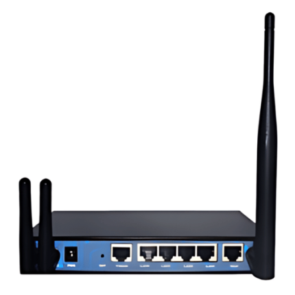
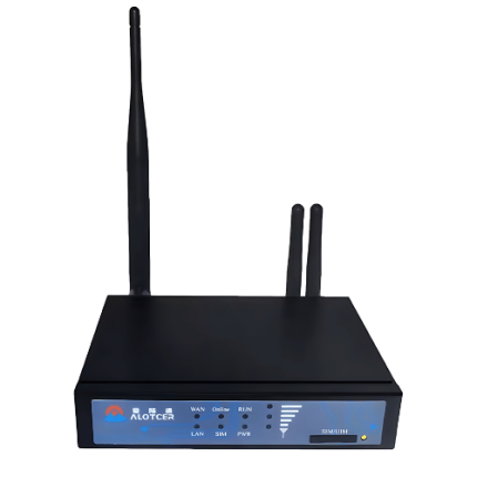
12V IoT Gateway VPN Router with Industrial CPU, WLAN, and Cellular – GAOTek


2.4 in WiFi 4G Wireless Smart Home Security System – GAOTek


3 Band GSM or 3G or 4G Signal Booster – GAOTek


300Mbps 4G LTE Portable Wifi Router with SIM Slot – GAOTek


4G Cellular Modem Router with External Antennas and Multiuser Support – GAOTek


4G Cellular Modem with Dual-Band Wi-Fi and Rotatable Antennas – GAOTek


4G Fixed Wireless Terminal VoLTE WiFi Hotspot HD Voice – GAOTek
Here are the LoRaWAN End Devices offered by GAO Tek:
12V IoT Gateway VPN Router with Industrial CPU, WLAN, and Cellular – GAOTek
2.4 in WiFi 4G Wireless Smart Home Security System – GAOTek
3 Band GSM or 3G or 4G Signal Booster – GAOTek
300Mbps 4G LTE Portable Wifi Router with SIM Slot – GAOTek
4G Cellular Modem Router with External Antennas and Multiuser Support – GAOTek
4G Cellular Modem with Dual-Band Wi-Fi and Rotatable Antennas – GAOTek
4G Fixed Wireless Terminal VoLTE WiFi Hotspot HD Voice – GAOTek
Navigation Menu for LoRaWAN
- LoRaWAN Gateways
- LoRaWAN End Devices
- LoRaWAN – Cloud, Server, PC & Mobile Systems
- LoRaWAN Accessories
- LoRaWAN Resources