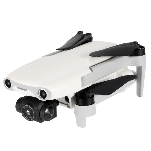
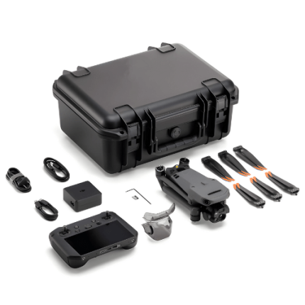
Description
Overview
The thermal imaging drone has a maximum rising speed of 19.68 ft and a maximum take-off altitude of 2.49 mi including a maximum flight time of 28 min.
Features
- Headless mode
- Altitude Hold Mode
- 3D View Mode
- Camera
- LED lights
- G-sensor
- 3D flip
- One Key Take-off and Landing,
- APP Control
- Voice control
- Remote Control
- Foldable
Technical Specifications
| Maximum Rising Speed | 19.67 ft (6 m) or S (motion), 13.12 ft (4 m) or S (normal), 9.84 ft (3m) or S (stable) |
| Maximum Descent Speed | 13.12 ft (4 m) / S (motion), 9.84 ft (3 m) / S (normal), 2m / S (stable) |
| Maximum Horizontal Flight Speed (No Wind Near Sea Level) |
49.21 ft (15 m) / S (motion), 38.81 ft (10 m) / S (normal), 16.4 ft (5 m) / S (stable) |
| Maximum Take-Off Altitude | 2.48 mi (4000 m) |
| Maximum Flight Time (Windless Environment) |
28 min |
| Maximum Hover Time (Windless Environment) |
26 min |
| Maximum Range (Windless Environment) |
9.94 mi (6.8 km) |
| Maximum Wind Resistance Grade | Level 5 wind |
| Maximum Tilt Angle | 33 ° (motion), 25 ° (normal), 25 ° (stable) |
| Maximum Rotational Angular Velocity | 200 ° (motion), 120 ° (normal), 60 ° (stable) |
| Operating Ambient Temperature | 0 °F to 104 °F (0 °C to 40 °C) |
| Working Frequency | 2.400 GHz to 2.4835 GHz 5.725 GHz to 5.850 GHz 5.150 GHz to 5.250 GHz |
| Transmission Frequency (EIRP) | FCC:≤30 dBm |
| Satellite Navigation System | GPS |
| Hover Accuracy | Vertical: ± 0.33 ft (0.1 m) (when visual positioning works normally), ± 1.64 ft (0.5 m) (when GPS works normally) Horizontal: ± 0.98 ft (0.3 m) (when visual positioning works normally), ± 4.92 ft (1.5 m) (when GPS works normally) |
| Airborne Memory | NO |
| Take-Off Weight | 0.55 lb (249 g) |
| Dimensions (Including Blades) | Folding: 5.59 in × 3.70 in × 0.18 in (142 × 94 × 55mm) (long × Wide × High) Expand:10.24 in × 5.31 in × 0.18 in (260 mm × 135 mm × 55 mm) long × Wide × High) |
| Diagonal Wheelbase | 0.76 in (231 mm) |


