Surveying Instrument with High Precision Dual Frequency Receiver – GAOTek
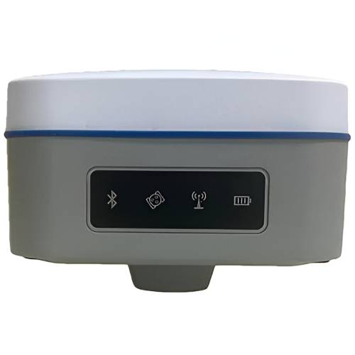
Explore the Surveying Instrument. Perfect for accurate geospatial measurements in various surveying applications with advanced features and reliability.
SKU:
GAOTek-RNBDL-165
Category: Rugged NB-IoT Data Loggers
Description
Description
Technical Specifications
| Channels | 1408 Channels |
| GPS | L1 C/A, L1C*, L2P(Y), L2C, L5 |
| GLONASS | L1, L2 |
| BeiDou (BDS) | B1I, B2I, B3I, B1C, B2a, B2b* |
| Galileo | E1, E5a, E5b |
| QZSS | L1, L2, L5 |
| Data Format | NMEA-0183 |
| Tilt Compensation Accuracy | <0.787 in (2cm) (within 60°) |
| Data Update Frequency | 5Hz |
| Correction I/O Protocol | RTCM 2.X, RTCM 3.X |
| Recapture Time | <1s |
| Positioning Accuracy (Single) | Horizontal: 4.92 feet (1.5m), Vertical: 8.2 feet (2.5m) |
| Positioning Accuracy (DGPS) | Horizontal: 1.31 feet (0.4m), Vertical: 2.62 feet (0.8m) |
| Positioning Accuracy (RTK) | Horizontal: ±(0.31 in (0.8) +1ppm), Vertical: ±(0.59 in (1.5) +1ppm) |
| Time Accuracy (RMS) | 20ns |
| Static Accuracy (RMS) | Horizontal: ± (0.098 in (0.25) +0.5ppm), Vertical: ± (0.098 in (0.25)+0.5ppm) |
| Speed Accuracy (RMS) | 0.03m/s |
| Bluetooth | V2.1+EDR / V4.0 dual mode |
| Wi-Fi | 802.11 b/g/n |
| Network | LTE FDD: B1/2/3/4/5/7/8/12/13/18/19/20/25/26/28; LTE TDD: B38/39/40/41; WCDMA: B1/2/4/5/6/8/19; GSM: B2/3/5/8 |
| Data Radio Frequency | 410 MHz to 470MHz |
| Data Radio Protocol | TRIMTALK, TRIMMK3, SOUTH, TRANSE OT |
| RF Transmit Power | 1 W/5 W |
| Air Baud Rate | 9600 / 19200 bps |
| Storage | 32GB (User Storage: 24GB) |
| Indicators | Power, Bluetooth, Satellite, Data Link, Network Indicators |
| Battery | 7.4V, 6500mAh |
| Work Time | More than 20 hours (typical, Rover mode, Built-in network chain) |
| Charge | USB PD 12V/2A, 5V/3A |
| Protection | IP68 (Waterproof), Shock: Withstand 1.5M pole drop |
| Material | Magnesium alloy main body, ABS/PC top cover |
| A Full Set Includes | M68K Device (1 set), Power Adapter (1 PCS), USB A to Type-C (1 PCS), Radio Antenna (1 PCS) |
| Work Temperature | -4°F to 140°F (-20℃ to +60℃) |
| Storage Temperature | -40°F to 185°F (-40℃ to +85℃) |
| Weight | ≤1.65 lb (0.75kg) |
| Dimensions | 5.65 in x 3.57 in (14.35 cm x 9.07 cm) |


